Master Erasmus Mundus - Copernicus Master in Digital Earth
Master Erasmus Mundus - Copernicus Master in Digital EarthThe two year full-time integrated Erasmus Mundus Joint Master Degree (EMJMD) Programme aims at qualifying individuals to lead initiatives, projects and institutions translating Copernicus services into management decisions within a broader Digital Earth vision.

Digital Earth, focusing on the interaction between humans and virtual representations
Digital Earth is a concept well established since 1998, focusing on the interaction between humans and virtual representations of our world from local to global scales. More recently, this concept has gained traction as a framework for leveraging geospatial technologies for better management of our societies, environments and economies. Quoting the 2009 Beijing DE Declaration: “Digital Earth is an integral part of advanced technologies including: earth observation, geo-information systems, global positioning systems, communication networks, sensor webs, electromagnetic identifiers, virtual reality, grid computation, etc. It is seen as a global strategic contributor to scientific and technological developments, and will be a catalyst in finding solutions to international scientific and societal issues.”
The EU Earth Observation Programme Copernicus
The EU Earth Observation Programme Copernicus offers information services based on satellite and in situ acquired geospatial data. Open data access has greatly enhanced the potential for realizing a range of societal benefits, the proposed Joint Master Programme addresses the associated capacity building needs on a graduate level. From the above quoted document “Digital Earth plays a strategic and sustainable role in addressing challenges to human society as natural resource depletion, food and water insecurity, energy shortages, environmental degradation, natural disasters response, population explosion, and, in particular, global climate change” it is made clear that a European qualification in this field will have to address key themes like Atmosphere and Climate, Marine and Land Environments, Security and Emergency Management.
The University of Salzburg is building on its established 30 year record of educating‚ experts for a spatial view‘, and is joining forces with partners complementing its geospatial methodology foundations with key specialisation components. Olomouc University‘s leadership in geovisualisation and geocommunication, and University of South Brittany alternatively emphasizing methods in big earth data / image analytics and machine learning. Jointly, these tracks offer outstanding candidates a pathway towards excellence in advanced Geoinformatics addressing the Copernicus and Digital Earth missions and objectives.
Geospatial technologies
Geospatial technologies and underlying concepts have become indispensable elements in today’s information society, location connects (‘joins’) information assets and provides the context for perceptions, decisions and actions. A lack of qualifications has been identified by multiple actors as a key bottleneck and impediment for more broadly leveraging the potential of Geoinformatics to managing our world in all its geospatial facets, including addressing Sustainable Development Goals.
- Faculty of Law and Political Science
Faculty of Law and Political ScienceCampus Vannes · 02 97 01 26 00 - Faculty of Arts, Humanities and Social Sciences
Faculty of Arts, Humanities and Social SciencesCampus Lorient · 02 97 87 29 29 - Faculty of Sciences and Engineering Sciences
Faculty of Sciences and Engineering SciencesCampus Lorient · 02 97 88 05 50
Campus Vannes · 02 97 01 70 70 - School of Engineering
School of EngineeringCampus Lorient · 02 97 88 05 59
Campus Vannes · 02 97 01 72 73 - Lorient and Pontivy Institute of Technology
Lorient and Pontivy Institute of TechnologyCampus Lorient · 02 97 87 28 00
Campus Pontivy · 02 97 27 67 70 - Vannes Institute of Technology
Vannes Institute of TechnologyCampus Vannes-Kercado · 02 97 62 64 64 - IAE Bretagne Sud
IAE Bretagne SudCampus Vannes · 02 97 01 26 05
 Lorient Campus27 rue Armand Guillemot
CS 7030, 56321 LORIENT Cedex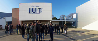 Pontivy CampusAllée des Pommiers
56300 Pontivy Vannes CampusRue André Lwoff
CS 60573, 56017 VANNES Cedex